


Voting District 0900000, Suffolk County, New York
About
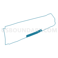
Outline

Summary
| Unique Area Identifier | 637414 |
| Name | Voting District 0900000 |
| County | Suffolk County |
| State | New York |
| Area (square miles) | 97.04 |
| Land Area (square miles) | 0.00 |
| Water Area (square miles) | 97.04 |
| % of Land Area | 0.00 |
| % of Water Area | 100.00 |
| Latitude of the Internal Point | 40.81832330 |
| Longtitude of the Internal Point | -72.47499430 |
Maps


Graphs
Select a template below for downloading or customizing gragh for Voting District 0900000, Suffolk County, New York


Neighbors
Neighoring Voting District (by Name) Neighboring Voting District on the Map
- Voting District 0200014, Suffolk County, NY
- Voting District 0300007, Suffolk County, NY
- Voting District 0300012, Suffolk County, NY
- Voting District 0900004 0900016, Suffolk County, NY
- Voting District 0900005, Suffolk County, NY
- Voting District 0900009 0900030, Suffolk County, NY
- Voting District 0900010, Suffolk County, NY
- Voting District 0900013, Suffolk County, NY
- Voting District 0900014, Suffolk County, NY
- Voting District 0900018, Suffolk County, NY
- Voting District 0900024, Suffolk County, NY
- Voting District 0900026, Suffolk County, NY
- Voting District 0900034, Suffolk County, NY
Top 10 Neighboring County Subdivision (by Population) Neighboring County Subdivision on the Map
- Brookhaven town, Suffolk County, NY (486,040)
- Southampton town, Suffolk County, NY (56,790)
- East Hampton town, Suffolk County, NY (21,457)
Top 10 Neighboring Place (by Population) Neighboring Place on the Map
- Hampton Bays CDP, NY (13,603)
- East Quogue CDP, NY (4,757)
- Southampton village, NY (3,109)
- Westhampton CDP, NY (3,079)
- Bridgehampton CDP, NY (1,756)
- Westhampton Beach village, NY (1,721)
- Water Mill CDP, NY (1,559)
- Quogue village, NY (967)
- Wainscott CDP, NY (650)
- Sagaponack village, NY (313)
Top 10 Neighboring Elementary School District (by Population) Neighboring Elementary School District on the Map
Top 10 Neighboring Unified School District (by Population) Neighboring Unified School District on the Map
- Hampton Bays Union Free School District, NY (13,136)
- Southampton Union Free School District, NY (10,093)
- East Moriches Union Free School District, NY (5,755)
- Westhampton Beach Union Free School District, NY (5,571)
- East Quogue Union Free School District, NY (4,643)
- Bridgehampton Union Free School District, NY (1,519)
- Quogue Union Free School District, NY (1,080)
- Wainscott Common School District, NY (657)
- Sagaponack Common School District, NY (308)
Top 10 Neighboring State Legislative District Lower Chamber (by Population) Neighboring State Legislative District Lower Chamber on the Map
Top 10 Neighboring State Legislative District Upper Chamber (by Population) Neighboring State Legislative District Upper Chamber on the Map
Top 10 Neighboring 111th Congressional District (by Population) Neighboring 111th Congressional District on the Map
Top 10 Neighboring Census Tract (by Population) Neighboring Census Tract on the Map
- Census Tract 2009.02, Suffolk County, NY (6,410)
- Census Tract 1906.01, Suffolk County, NY (4,438)
- Census Tract 1906.04, Suffolk County, NY (4,394)
- Census Tract 1907.05, Suffolk County, NY (4,163)
- Census Tract 1907.04, Suffolk County, NY (3,141)
- Census Tract 1908, Suffolk County, NY (3,109)
- Census Tract 1905.02, Suffolk County, NY (2,537)
- Census Tract 1905.04, Suffolk County, NY (1,846)
- Census Tract 1595.10, Suffolk County, NY (82)
- Census Tract 9901, Suffolk County, NY (0)
Top 10 Neighboring 5-Digit ZIP Code Tabulation Area (by Population) Neighboring 5-Digit ZIP Code Tabulation Area on the Map
- 11946, NY (14,068)
- 11968, NY (11,593)
- 11942, NY (4,603)
- 11978, NY (3,255)
- 11976, NY (1,565)
- 11932, NY (1,398)
- 11962, NY (494)
- 11975, NY (408)